
Cadalso topographic map
Interactive map
Click on the map to display elevation.
About this map
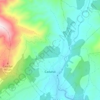
Name: Cadalso topographic map, elevation, terrain.
Location: Cadalso, Sierra de Gata, Cáceres, Extremadura, 10865, España (40.22350 -6.55349 40.27260 -6.50639)
Average elevation: 571 m
Minimum elevation: 392 m
Maximum elevation: 1,149 m