
Ivrea topographic map
Click on the map to display elevation.
Ivrea
Ivrea is situated at an altitude of approximately 267 meters above sea level, not far from the entrance to the Aosta Valley. It is crossed by the Dora Baltea river, a tributary of the Po, and is located in an area shaped by a large Pleistocene glacier, which over time transported numerous debris that formed a series of moraine hills, including the Serra d'Ivrea, which collectively form the Ivrea Morainic Amphitheatre.
About this map
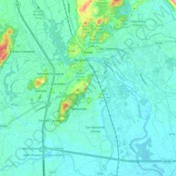
Name: Ivrea topographic map, elevation, terrain.
Location: Ivrea, Turin, Piedmont, Italy (45.41318 7.84191 45.49012 7.93073)
Average elevation: 243 m
Minimum elevation: 218 m
Maximum elevation: 382 m
Other topographic maps
Click on a map to view its topography, its elevation and its terrain.
Parco Generale Carlo Alberto Dalla Chiesa
Italy > Piedmont > Turin > Collegno
Average elevation: 297 m