
Thank you for supporting this site ❤️
Make a donation
Make a donation
Rundu topographic map
Click on the map to display elevation.
Thank you for supporting this site ❤️
Make a donation
Make a donation
About this map
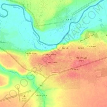
Name: Rundu topographic map, elevation, terrain.
Location: Rundu, Kavango East, Namibia (-17.94083 19.70621 -17.89652 19.80729)
Average elevation: 1,090 m
Minimum elevation: 1,060 m
Maximum elevation: 1,121 m
Thank you for supporting this site ❤️
Make a donation
Make a donation