
Rieder topographic map
Interactive map
Click on the map to display elevation.
About this map
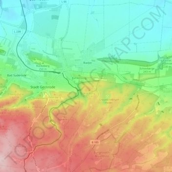
Name: Rieder topographic map, elevation, terrain.
Location: Rieder, Ballenstedt, Landkreis Harz, Saksen-Anhalt, Duitsland (51.68985 11.14930 51.75892 11.22742)
Average elevation: 265 m
Minimum elevation: 138 m
Maximum elevation: 460 m