
京都市 topographic map
Interactive map
Click on the map to display elevation.
About this map
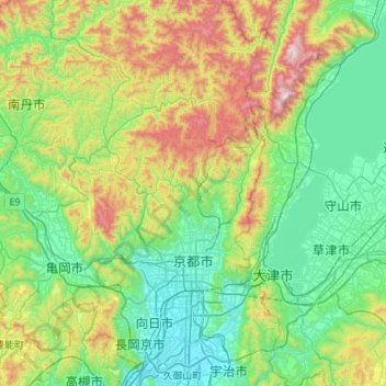
Name: 京都市 topographic map, elevation, terrain.
Location: 京都市, Prefectura de Kioto, 近畿地方, Japón (34.87492 135.55901 35.32124 135.87844)
Average elevation: 311 m
Minimum elevation: 5 m
Maximum elevation: 1,182 m
Other topographic maps
Click on a map to view its topography, its elevation and its terrain.