
Disentis topographic map
Interactive map
Click on the map to display elevation.
About this map
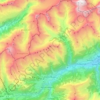
Name: Disentis topographic map, elevation, terrain.
Location: Disentis, Surselva, Graubünden, 7180, Schweiz (46.67093 8.77152 46.81443 8.91486)
Average elevation: 2,068 m
Minimum elevation: 884 m
Maximum elevation: 3,574 m