
Thank you for supporting this site ❤️
Make a donation
Make a donation
Sasura topographic map
Click on the map to display elevation.
Thank you for supporting this site ❤️
Make a donation
Make a donation
About this map
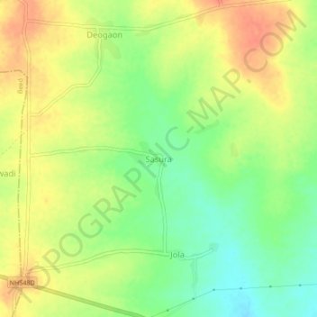
Name: Sasura topographic map, elevation, terrain.
Location: Sasura, Kaij, Beed, Maharashtra, India (18.76955 75.87351 18.80955 75.91351)
Average elevation: 729 m
Minimum elevation: 704 m
Maximum elevation: 750 m
Thank you for supporting this site ❤️
Make a donation
Make a donation