
Thank you for supporting this site ❤️
Make a donation
Make a donation
el Molar topographic map
Click on the map to display elevation.
Thank you for supporting this site ❤️
Make a donation
Make a donation
About this map
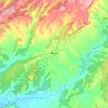
Name: el Molar topographic map, elevation, terrain.
Location: el Molar, Priorat, Tarragona, Catalonia, 43736, Spain (41.13431 0.65837 41.19055 0.75030)
Average elevation: 216 m
Minimum elevation: 27 m
Maximum elevation: 520 m
Thank you for supporting this site ❤️
Make a donation
Make a donation
Other topographic maps
Click on a map to view its topography, its elevation and its terrain.