
Yomaboua topographic map
Interactive map
Click on the map to display elevation.
About this map
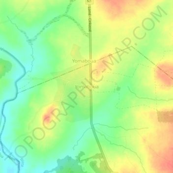
Name: Yomaboua topographic map, elevation, terrain.
Location: Yomaboua, Préfecture de Blitta, Région Centrale, Togo (8.37454 0.97138 8.41454 1.01138)
Average elevation: 321 m
Minimum elevation: 296 m
Maximum elevation: 346 m
Other topographic maps
Click on a map to view its topography, its elevation and its terrain.
Blitta
Togo > Région Centrale > Préfecture de Blitta
Blitta, Préfecture de Blitta, Région Centrale, Togo
Average elevation: 336 m