
Kaputar topographic map
Interactive map
Click on the map to display elevation.
About this map
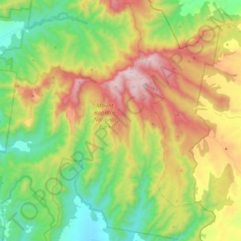
Name: Kaputar topographic map, elevation, terrain.
Location: Kaputar, Bark Hut, Narrabri, Neusüdwales, 2390, Australien (-30.40032 150.05335 -30.21981 150.23855)
Average elevation: 744 m
Minimum elevation: 310 m
Maximum elevation: 1,493 m