
Manning topographic map
Interactive map
Click on the map to display elevation.
About this map
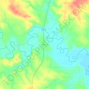
Name: Manning topographic map, elevation, terrain.
Location: Manning, Dunn County, North Dakota, United States (47.21002 -102.79019 47.25002 -102.75019)
Average elevation: 681 m
Minimum elevation: 655 m
Maximum elevation: 723 m
Other topographic maps
Click on a map to view its topography, its elevation and its terrain.
Killdeer
United States > North Dakota > Dunn County > Killdeer
Killdeer, Dunn County, North Dakota, 58640, United States
Average elevation: 693 m