
Arisdorf topographic map
Interactive map
Click on the map to display elevation.
About this map
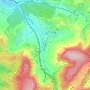
Name: Arisdorf topographic map, elevation, terrain.
Location: Arisdorf, Bezirk Liestal, Basel-Landschaft, 4422, Schweiz (47.49034 7.74100 47.52605 7.79203)
Average elevation: 444 m
Minimum elevation: 305 m
Maximum elevation: 631 m