
Kiribathgoda topographic map
Interactive map
Click on the map to display elevation.
About this map
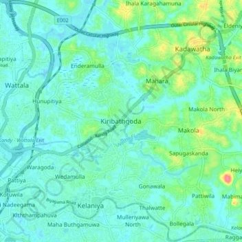
Name: Kiribathgoda topographic map, elevation, terrain.
Average elevation: 14 m
Minimum elevation: -2 m
Maximum elevation: 65 m
Other topographic maps
Click on a map to view its topography, its elevation and its terrain.
Dalugama
Sri Lanka > Western Province > Kiribathgoda
Dalugama, Kiribathgoda, Gampaha District, Western Province, 11600, Sri Lanka
Average elevation: 11 m