
Thank you for supporting this site ❤️
Make a donation
Make a donation
Tamhini topographic map
Click on the map to display elevation.
Thank you for supporting this site ❤️
Make a donation
Make a donation
About this map
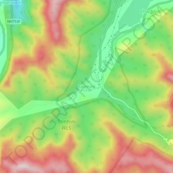
Name: Tamhini topographic map, elevation, terrain.
Location: Tamhini, Mulshi, Pune District, Maharashtra, India (18.42523 73.40810 18.46523 73.44810)
Average elevation: 731 m
Minimum elevation: 499 m
Maximum elevation: 989 m
Thank you for supporting this site ❤️
Make a donation
Make a donation
Other topographic maps
Click on a map to view its topography, its elevation and its terrain.