
Pohlheim topographic map
Interactive map
Click on the map to display elevation.
About this map
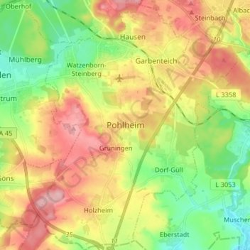
Name: Pohlheim topographic map, elevation, terrain.
Location: Pohlheim, Landkreis Gießen, Hesse, 35415, Germany (50.47482 8.68865 50.55796 8.78969)
Average elevation: 218 m
Minimum elevation: 154 m
Maximum elevation: 293 m