Wyre Forest topographic map
Interactive map
Click on the map to display elevation.
About this map
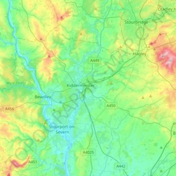
Name: Wyre Forest topographic map, elevation, terrain.
Average elevation: 92 m
Minimum elevation: 16 m
Maximum elevation: 311 m

Click on the map to display elevation.
Name: Wyre Forest topographic map, elevation, terrain.
Average elevation: 92 m
Minimum elevation: 16 m
Maximum elevation: 311 m