
Multani Tanda topographic map
Interactive map
Click on the map to display elevation.
About this map
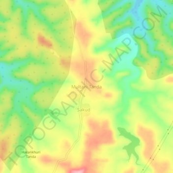
Name: Multani Tanda topographic map, elevation, terrain.
Location: Multani Tanda, Ambejogai, Beed District, Maharashtra, India (18.76625 76.41227 18.80625 76.45227)
Average elevation: 580 m
Minimum elevation: 512 m
Maximum elevation: 651 m