
Lerici topographic map
Interactive map
Click on the map to display elevation.
About this map
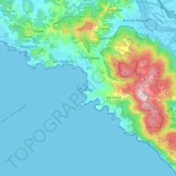
Name: Lerici topographic map, elevation, terrain.
Location: Lerici, La Spezia, Ligurie, 19032, Italie (44.04759 9.87742 44.10093 9.96652)
Average elevation: 77 m
Minimum elevation: -4 m
Maximum elevation: 410 m