
Cheyyur topographic map
Interactive map
Click on the map to display elevation.
About this map
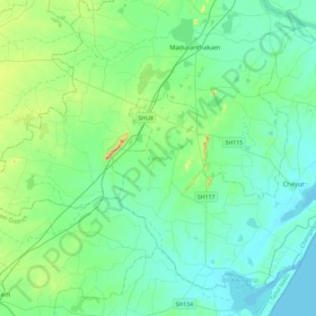
Name: Cheyyur topographic map, elevation, terrain.
Location: Cheyyur, Chengalpattu District, Tamil Nadu, India (12.23203 79.78847 12.53127 80.15752)
Average elevation: 32 m
Minimum elevation: -2 m
Maximum elevation: 180 m
Other topographic maps
Click on a map to view its topography, its elevation and its terrain.
Cheyur
India > Tamil Nadu > Cheyyur > Cheyur
Cheyur, Cheyyur, Chengalpattu District, Tamil Nadu, 603302, India
Average elevation: 8 m