
Oulton topographic map
Interactive map
Click on the map to display elevation.
About this map
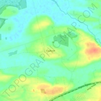
Name: Oulton topographic map, elevation, terrain.
Average elevation: 19 m
Minimum elevation: 5 m
Maximum elevation: 47 m
Other topographic maps
Click on a map to view its topography, its elevation and its terrain.
Oulton
United Kingdom > England > Oulton
Oulton, Suffolk, East of England, England, NR32 3BJ, United Kingdom
Average elevation: 12 m
Oulton
United Kingdom > England > Oulton
Oulton, Norfolk, East of England, England, NR11 6NU, United Kingdom
Average elevation: 41 m