
Thank you for supporting this site ❤️
Make a donation
Make a donation
Port Orchard topographic map
Click on the map to display elevation.
Thank you for supporting this site ❤️
Make a donation
Make a donation
About this map
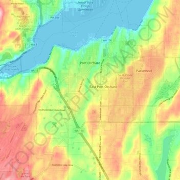
Name: Port Orchard topographic map, elevation, terrain.
Location: Port Orchard, Kitsap County, Washington, United States (47.48174 -122.72156 47.55692 -122.60203)
Average elevation: 71 m
Minimum elevation: -3 m
Maximum elevation: 162 m
Thank you for supporting this site ❤️
Make a donation
Make a donation