
Yedgaon Reservoir topographic map
Interactive map
Click on the map to display elevation.
About this map
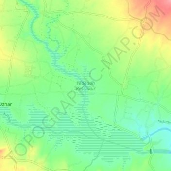
Name: Yedgaon Reservoir topographic map, elevation, terrain.
Location: Yedgaon Reservoir, Junnar, Pune District, Maharashtra, India (19.16074 73.95153 19.23052 74.02349)
Average elevation: 650 m
Minimum elevation: 620 m
Maximum elevation: 706 m
Other topographic maps
Click on a map to view its topography, its elevation and its terrain.
Shivneri Fort
India > Maharashtra > Junnar > Junnar
Shivneri Fort, Junnar, Pune, Maharashtra, India
Average elevation: 746 m
Ghatghar
India > Maharashtra > Junnar
Ghatghar, Junnar, Pune, Maharashtra, India
Average elevation: 757 m
Naneghat
India > Maharashtra > Junnar
Naneghat, Junnar, Pune, Maharashtra, India
Average elevation: 422 m