
Cileungsir topographic map
Interactive map
Click on the map to display elevation.
About this map
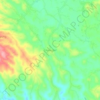
Name: Cileungsir topographic map, elevation, terrain.
Location: Cileungsir, Ciamis, West Java, Indonesia (-7.24229 108.47742 -7.20229 108.51742)
Average elevation: 355 m
Minimum elevation: 308 m
Maximum elevation: 435 m
Other topographic maps
Click on a map to view its topography, its elevation and its terrain.