
Thank you for supporting this site ❤️
Make a donation
Make a donation
Yvu Santa Rita topographic map
Click on the map to display elevation.
Thank you for supporting this site ❤️
Make a donation
Make a donation
About this map
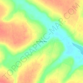
Name: Yvu Santa Rita topographic map, elevation, terrain.
Location: Yvu Santa Rita, Caaguazú, Región Oriental, Paraguay (-25.03082 -55.56538 -24.99082 -55.52538)
Average elevation: 254 m
Minimum elevation: 220 m
Maximum elevation: 284 m
Thank you for supporting this site ❤️
Make a donation
Make a donation
Other topographic maps
Click on a map to view its topography, its elevation and its terrain.