
Artuklu topographic map
Interactive map
Click on the map to display elevation.
About this map
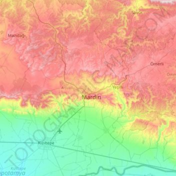
Name: Artuklu topographic map, elevation, terrain.
Location: Artuklu, Mardin, Güneydoğu Anadolu Bölgesi, Turquia (37.10552 40.52689 37.53366 41.07527)
Average elevation: 837 m
Minimum elevation: 441 m
Maximum elevation: 1,298 m
Other topographic maps
Click on a map to view its topography, its elevation and its terrain.
Harran
Turquia > Güneydoğu Anadolu Bölgesi > Harran
Harran, Şanlıurfa, Güneydoğu Anadolu Bölgesi, Turquia
Average elevation: 364 m
Pınarcık
Turquia > Güneydoğu Anadolu Bölgesi > Pınarcık
Pınarcık, Ömerli, Mardin, Güneydoğu Anadolu Bölgesi, Turquia
Average elevation: 1,044 m