
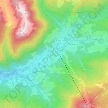
Rußbach am Paß Gschütt topographic map
Interactive map
Click on the map to display elevation.
About this map
Name: Rußbach am Paß Gschütt topographic map, elevation, terrain.
Location: Rußbach am Paß Gschütt, Hallein, Salzburg, 5442, Österreich (47.56753 13.44078 47.60753 13.48078)
Average elevation: 1,022 m
Minimum elevation: 727 m
Maximum elevation: 1,509 m
Other topographic maps
Click on a map to view its topography, its elevation and its terrain.
Rußbach am Paß Gschütt
Österreich > Salzburg > Rußbach am Paß Gschütt
Rußbach am Paß Gschütt, Bezirk Hallein, Salzburg, 5442, Österreich
Average elevation: 1,173 m