
Thank you for supporting this site ❤️
Make a donation
Make a donation
Dover Forge topographic map
Click on the map to display elevation.
Thank you for supporting this site ❤️
Make a donation
Make a donation
About this map
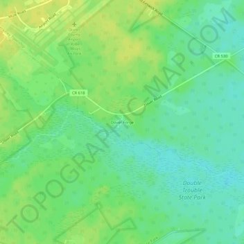
Name: Dover Forge topographic map, elevation, terrain.
Average elevation: 20 m
Minimum elevation: 10 m
Maximum elevation: 31 m
Thank you for supporting this site ❤️
Make a donation
Make a donation
Other topographic maps
Click on a map to view its topography, its elevation and its terrain.
Island Beach State Park
United States > New Jersey > Ocean County > Berkeley Township
Average elevation: 1 m