
Vest-Agder topographic map
Interactive map
Click on the map to display elevation.
About this map
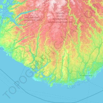
Name: Vest-Agder topographic map, elevation, terrain.
Location: Vest-Agder, Norvège (57.75901 6.14970 59.18969 8.37168)
Average elevation: 321 m
Minimum elevation: -2 m
Maximum elevation: 1,404 m