
Thank you for supporting this site ❤️
Make a donation
Make a donation
Statham topographic map
Click on the map to display elevation.
Thank you for supporting this site ❤️
Make a donation
Make a donation
About this map
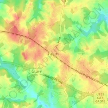
Name: Statham topographic map, elevation, terrain.
Location: Statham, Barrow County, Georgia, United States (33.94898 -83.63887 33.98126 -83.57542)
Average elevation: 261 m
Minimum elevation: 232 m
Maximum elevation: 287 m
Thank you for supporting this site ❤️
Make a donation
Make a donation
Other topographic maps
Click on a map to view its topography, its elevation and its terrain.