
Thank you for supporting this site ❤️
Make a donation
Make a donation
Apache Flats topographic map
Click on the map to display elevation.
Thank you for supporting this site ❤️
Make a donation
Make a donation
About this map
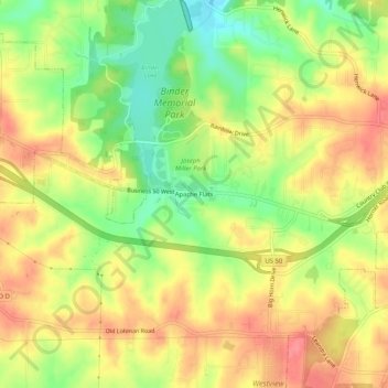
Name: Apache Flats topographic map, elevation, terrain.
Location: Apache Flats, Cole County, Missouri, United States (38.56364 -92.31963 38.60364 -92.27963)
Average elevation: 224 m
Minimum elevation: 183 m
Maximum elevation: 256 m
Thank you for supporting this site ❤️
Make a donation
Make a donation
Other topographic maps
Click on a map to view its topography, its elevation and its terrain.