
Avister topographic map
Interactive map
Click on the map to display elevation.
About this map
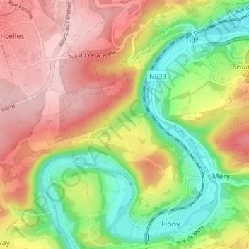
Name: Avister topographic map, elevation, terrain.
Location: Avister, Esneux, Liège, Wallonia, 4130, Belgium (50.53601 5.54741 50.57601 5.58741)
Average elevation: 170 m
Minimum elevation: 64 m
Maximum elevation: 275 m
Other topographic maps
Click on a map to view its topography, its elevation and its terrain.