
Casper topographic map
Interactive map
Click on the map to display elevation.
About this map
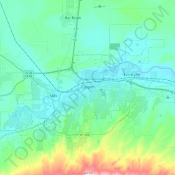
Name: Casper topographic map, elevation, terrain.
Average elevation: 1,635 m
Minimum elevation: 1,546 m
Maximum elevation: 2,010 m
Other topographic maps
Click on a map to view its topography, its elevation and its terrain.
Casper
Vereinigte Staaten von Amerika > Wyoming > Natrona County > Casper
Casper, Natrona County, Wyoming, 82601, Vereinigte Staaten von Amerika
Average elevation: 1,727 m