
Thank you for supporting this site ❤️
Make a donation
Make a donation
Waynesville topographic map
Click on the map to display elevation.
Thank you for supporting this site ❤️
Make a donation
Make a donation
Waynesville
Most of the town of Waynesville lies between 2,600 and 3,000 feet (790 and 910 m) above sea level, in a valley among 5,000-to-6,410-foot (1,520 to 1,950 m) mountain peaks. With the high Great Balsam Mountains to the west-southwest, and the Plott Balsams to the west-northwest, a handful of peaks over 6000' in elevation are clearly visible from town. A USGS survey marker at the old Haywood County Courthouse in downtown Waynesville lists the elevation as 2,752 feet (839 m) above sea level.
Thank you for supporting this site ❤️
Make a donation
Make a donation
About this map
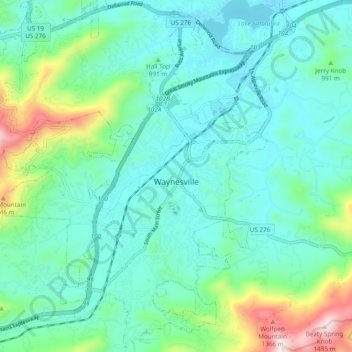
Name: Waynesville topographic map, elevation, terrain.
Average elevation: 921 m
Minimum elevation: 772 m
Maximum elevation: 1,484 m
Thank you for supporting this site ❤️
Make a donation
Make a donation