
Nag Tibba topographic map
Interactive map
Click on the map to display elevation.
About this map
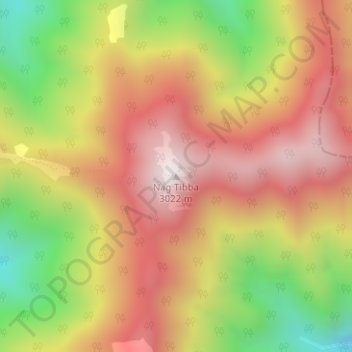
Name: Nag Tibba topographic map, elevation, terrain.
Location: Nag Tibba, Dhanaulti, Tehri Garhwal, Uttarakhand, India (30.58641 78.15144 30.58651 78.15154)
Average elevation: 2,600 m
Minimum elevation: 2,083 m
Maximum elevation: 3,007 m