
Barbacoas topographic map
Interactive map
Click on the map to display elevation.
About this map
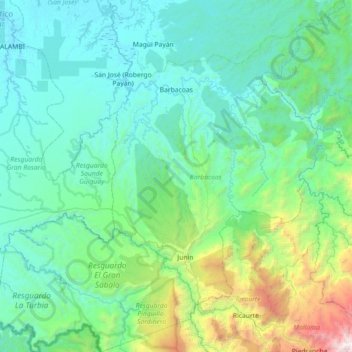
Name: Barbacoas topographic map, elevation, terrain.
Location: Barbacoas, Telembí, Nariño, RAP Pacífico, Colombia (1.13812 -78.50885 1.85447 -77.79117)
Average elevation: 537 m
Minimum elevation: -1 m
Maximum elevation: 3,776 m
Other topographic maps
Click on a map to view its topography, its elevation and its terrain.