
Molbergen topographic map
Interactive map
Click on the map to display elevation.
About this map
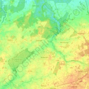
Name: Molbergen topographic map, elevation, terrain.
Location: Molbergen, Landkreis Cloppenburg, Nedersaksen, 49696, Duitsland (52.81683 7.79185 52.93660 7.99996)
Average elevation: 34 m
Minimum elevation: 17 m
Maximum elevation: 51 m