
Thank you for supporting this site ❤️
Make a donation
Make a donation
Arden topographic map
Click on the map to display elevation.
Thank you for supporting this site ❤️
Make a donation
Make a donation
About this map
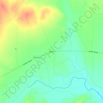
Name: Arden topographic map, elevation, terrain.
Location: Arden, Irion County, Texas, United States (31.42377 -100.78705 31.46377 -100.74705)
Average elevation: 637 m
Minimum elevation: 617 m
Maximum elevation: 668 m
Thank you for supporting this site ❤️
Make a donation
Make a donation
Other topographic maps
Click on a map to view its topography, its elevation and its terrain.