
Bandung topographic map
Interactive map
Click on the map to display elevation.
About this map
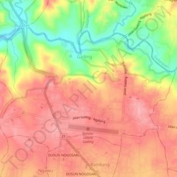
Name: Bandung topographic map, elevation, terrain.
Average elevation: 179 m
Minimum elevation: 108 m
Maximum elevation: 222 m
Other topographic maps
Click on a map to view its topography, its elevation and its terrain.
Karangasem
Indonésie > Daerah Istimewa Yogyakarta > Kabupaten Gunung Kidul
Karangasem, Paliyan, Kabupaten Gunung Kidul, Daerah Istimewa Yogyakarta, Jawa, Indonésie
Average elevation: 219 m