
Îles Gambier topographic map
Interactive map
Click on the map to display elevation.
About this map
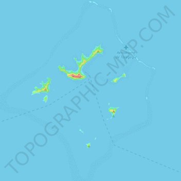
Name: Îles Gambier topographic map, elevation, terrain.
Average elevation: 2 m
Minimum elevation: 0 m
Maximum elevation: 382 m
Other topographic maps
Click on a map to view its topography, its elevation and its terrain.
Taravai
France > Polynésie française > Gambier
Taravai, Îles Gambier, Gambier, Tuamotu-Gambier, Polynésie française, France
Average elevation: 17 m