
Le Pâquier (FR) topographic map
Interactive map
Click on the map to display elevation.
About this map
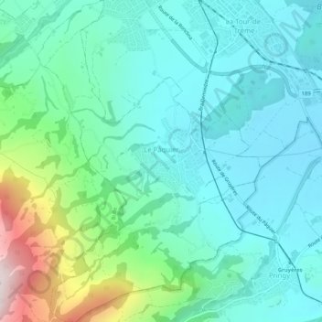
Name: Le Pâquier (FR) topographic map, elevation, terrain.
Location: Le Pâquier (FR), District de la Gruyère, Fribourg, 1661, Suisse (46.57622 7.03300 46.61134 7.06903)
Average elevation: 850 m
Minimum elevation: 706 m
Maximum elevation: 1,362 m