
Brünggen topographic map
Interactive map
Click on the map to display elevation.
About this map
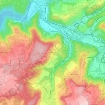
Name: Brünggen topographic map, elevation, terrain.
Average elevation: 584 m
Minimum elevation: 464 m
Maximum elevation: 698 m
Other topographic maps
Click on a map to view its topography, its elevation and its terrain.
Ettenhusen
Schweiz > Zürich > Bezirk Pfäffikon > Illnau-Effretikon > Kyburg
Ettenhusen, Kyburg, Illnau-Effretikon, Bezirk Pfäffikon, Zürich, 8314, Schweiz
Average elevation: 585 m
Kyburg
Schweiz > Zürich > Bezirk Pfäffikon > Illnau-Effretikon
Kyburg, Illnau-Effretikon, Bezirk Pfäffikon, Zürich, 8314, Schweiz
Average elevation: 571 m