
Thank you for supporting this site ❤️
Make a donation
Make a donation
Anmyeon Island topographic map
Click on the map to display elevation.
Thank you for supporting this site ❤️
Make a donation
Make a donation
About this map
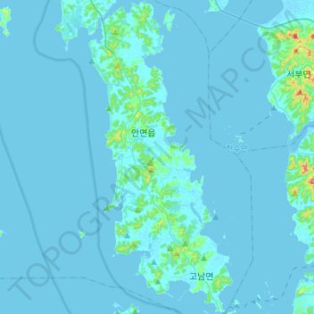
Name: Anmyeon Island topographic map, elevation, terrain.
Location: Anmyeon Island, Taean-gun, South Chungcheong, South Korea (36.39829 126.31240 36.61325 126.43508)
Average elevation: 7 m
Minimum elevation: -2 m
Maximum elevation: 174 m
Thank you for supporting this site ❤️
Make a donation
Make a donation