
Thank you for supporting this site ❤️
Make a donation
Make a donation
Edgar Springs topographic map
Click on the map to display elevation.
Thank you for supporting this site ❤️
Make a donation
Make a donation
About this map
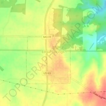
Name: Edgar Springs topographic map, elevation, terrain.
Location: Edgar Springs, Phelps County, Missouri, 65462, United States (37.69626 -91.87518 37.71203 -91.86090)
Average elevation: 359 m
Minimum elevation: 325 m
Maximum elevation: 385 m
Thank you for supporting this site ❤️
Make a donation
Make a donation
Other topographic maps
Click on a map to view its topography, its elevation and its terrain.