
Arregi topographic map
Interactive map
Click on the map to display elevation.
About this map
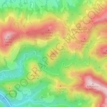
Name: Arregi topographic map, elevation, terrain.
Location: Arregi, Bera, Baztan-Bidasoa, Navarre, 31760, Espagne (43.26162 -1.65593 43.26172 -1.65583)
Average elevation: 225 m
Minimum elevation: 44 m
Maximum elevation: 413 m
Other topographic maps
Click on a map to view its topography, its elevation and its terrain.
Altzate
Espagne > Navarre > Baztan-Bidasoa > Bera
Altzate, Bera, Baztan-Bidasoa, 31770, Espagne
Average elevation: 188 m