
Quarry Park topographic map
Interactive map
Click on the map to display elevation.
About this map
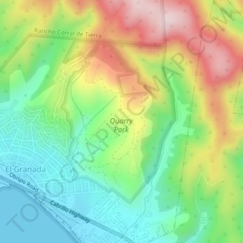
Name: Quarry Park topographic map, elevation, terrain.
Average elevation: 137 m
Minimum elevation: -1 m
Maximum elevation: 345 m
Other topographic maps
Click on a map to view its topography, its elevation and its terrain.
El Granada
United States > California > San Mateo County > El Granada
El Granada, San Mateo County, California, 94018, United States
Average elevation: 122 m
Pillar Point Harbor
United States > California > San Mateo County > El Granada
Pillar Point Harbor, El Granada, San Mateo County, California, 94018, United States
Average elevation: 13 m