
North Bend Lakeside Use Area topographic map
Interactive map
Click on the map to display elevation.
About this map
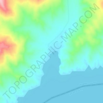
Name: North Bend Lakeside Use Area topographic map, elevation, terrain.
Average elevation: 466 m
Minimum elevation: 429 m
Maximum elevation: 588 m
Other topographic maps
Click on a map to view its topography, its elevation and its terrain.
Pierre
United States > South Dakota > Hughes County
Pierre, Hughes County, South Dakota, 57501, United States
Average elevation: 469 m
Blunt
United States > South Dakota > Hughes County
Blunt, Hughes County, South Dakota, United States
Average elevation: 504 m