
Rossinière topographic map
Interactive map
Click on the map to display elevation.
About this map
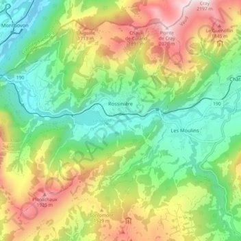
Name: Rossinière topographic map, elevation, terrain.
Average elevation: 1,278 m
Minimum elevation: 773 m
Maximum elevation: 2,094 m
Other topographic maps
Click on a map to view its topography, its elevation and its terrain.
Vevey
Schweiz > Waadt > District de la Riviera-Pays-d’Enhaut
Vevey, District de la Riviera-Pays-d’Enhaut, Waadt, 1800, Schweiz
Average elevation: 448 m
Montreux
Schweiz > Waadt > District de la Riviera-Pays-d’Enhaut
Montreux, District de la Riviera-Pays-d’Enhaut, Waadt, Schweiz
Average elevation: 820 m