
Cambará do Sul topographic map
Interactive map
Click on the map to display elevation.
About this map
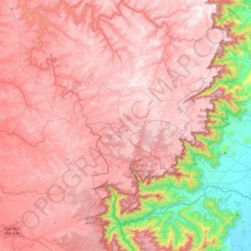
Name: Cambará do Sul topographic map, elevation, terrain.
Average elevation: 786 m
Minimum elevation: 1 m
Maximum elevation: 1,193 m
Other topographic maps
Click on a map to view its topography, its elevation and its terrain.
Parque Nacional da Serra Geral
Brésil > RS > Cambará do Sul
Parque Nacional da Serra Geral, CS-012, Cambará do Sul, Região Geográfica Imediata de Vacaria, Região Geográfica Intermediária de Caxias do Sul, RS, Région Sud, Brésil
Average elevation: 475 m