
Frosinone topographic map
Interactive map
Click on the map to display elevation.
About this map
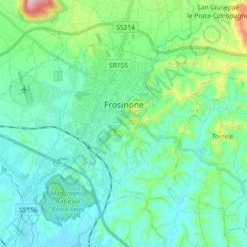
Name: Frosinone topographic map, elevation, terrain.
Location: Frosinone, Latium, 03100, Italie (41.60352 13.26380 41.66558 13.39277)
Average elevation: 198 m
Minimum elevation: 127 m
Maximum elevation: 503 m
Other topographic maps
Click on a map to view its topography, its elevation and its terrain.