
Thank you for supporting this site ❤️
Make a donation
Make a donation
Owk topographic map
Click on the map to display elevation.
Thank you for supporting this site ❤️
Make a donation
Make a donation
Owk
Owk is located at 15°13′00″N 78°07′00″E / 15.2167°N 78.1167°E / 15.2167; 78.1167. It has an average elevation of 194 meters (639 feet).
Thank you for supporting this site ❤️
Make a donation
Make a donation
About this map
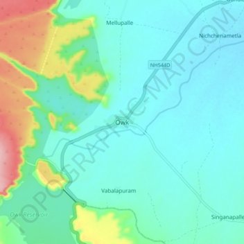
Name: Owk topographic map, elevation, terrain.
Location: Owk, Owk Mandal, Nandyal, Andhra Pradesh, India (15.16855 78.07651 15.24855 78.15651)
Average elevation: 223 m
Minimum elevation: 193 m
Maximum elevation: 336 m
Thank you for supporting this site ❤️
Make a donation
Make a donation